Wasatch Front 100 – Heaven, Hell, or Just Purgatory?

photo by Matt Jensen
Photo by Matt Jensen

It is now Thanksgiving weekend and I have had some time to reflect on the Wasatch 100 race and the rest of my summer and fall. Looking back on the last year of training, running, adventures and travel, I am thankful for the health, fitness, and support from family and friends – most of all my amazing wife Amy – which enabled me to train for and run this very difficult race. I have a lot to be thankful for, and experiences like these rank really high on the list for me.

The Wasatch was a pretty intense experience, but I haven’t felt inspired to write about it until now, partly due to a busy fall full of traveling and other adventures, capped off by racing The North Face Endurance Challenge SF 50 miler a week ago.

Back in early September, I flew from Oakland to Salt Lake City and stayed with my good friend Chris Johnson, who very kindly offered to crew me as well as put me up in his place for a few days. The day after the race was his first wedding anniversary, and he and his wife Kat had plans to go up to Snowbird for the weekend, but since the race started on Friday morning he was able to crew me on Friday and still spend the weekend with Kat. Score one for the Mormons – having the forethought to schedule the race on a Friday so they can run all night and into Saturday afternoon, and still make it to church on Sunday!

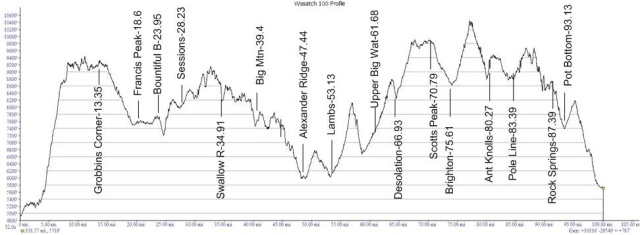
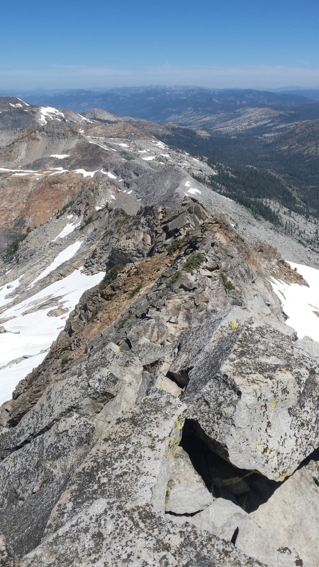
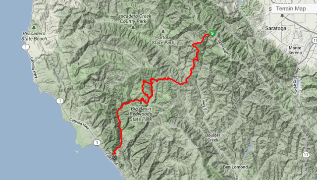
The Wasatch Front 100 is a point to point race, with about 24,000 feet of elevation gain and only 3 crew accessible locations – Big Mountain (mile 32.3), Lamb’s Canyon (mile 45.7), and Brighton (mile 67.1). It is one of the harder 100’s in the US and is a qualifier for Hardrock. The official race Motto is “100 Miles of Heaven and Hell”.

2011_wasatch_100 3
Approximate elevation profile (from 2011, the course has changed a bit since then)

Chris agreed to meet and crew me at the first two, and I found a local guy to pace me (Thanks Joe Jewkes!) for the last 33 miles starting at Brighton, where I was likely to arrive after dark. This was both my first official 100 mile race, and the first time I had the luxury of a crew or pacer! I was more worried about getting lost during the night section than anything else, so having a pacer with some knowledge of the course definitely helped put my mind at ease. I had never met him in person but I spoke to him on the phone the day before the race and he assured me he would be waiting at Brighton ready to go.

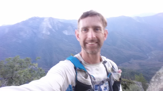
Me and Chris Johnson after climbing Half Dome, 2013 / Joe Jewkes after running all night, 2017

So I packed my drop bags, dropped them off at the pre-race meeting, and went to bed as early as possible – around 6pm I think. I got up at 2am, and Chris dropped me off at the bus which took us all to the start – in the East Mountain Wilderness park, near Kaysville, well north of Salt Lake City.  From there we would run 100 miles through the rugged Wasatch range, ending up at Soldier Hollow, well south of the city.  Or at least we would try – only about 2/3 of those who start actually finish.

For some reason it seems like there are never enough bathrooms or enough time to use them before the start of a big race, and this time was no different. I warmed up in line for the restroom and barely made it to the start line before the gun went off. The race started fast, with about three miles of pavement and easy dirt roads before the first monster climb up Bair Canyon – 4000 feet of narrow single-track climbing in about 4 miles. My strategy was to stay relatively close to the front in this first section, so I didn’t get stuck behind a conga line that could move only as fast as the slowest person at the front.

Unfortunately, somewhere around mile 2, I was following someone in the dark, cruising along a smooth dirt road, and we blew right by a sharp turn down a small, poorly marked trail to the right. Two other guys followed us and we went about 1/4 mile before realizing we were off track. By the time we backtracked to the turn we missed, we were solidly in the middle of the pack, and my heart sank with the realization that the dreaded conga line was now an inevitable part of my future.

Sure enough, the trail soon narrowed and steepened, and began its relentless ascent up Bair Canyon. The pace slowed to a crawl, and the line of mid-packers stretched in front of me as far as I could see – each seemingly content to go at the glacial pace of the one in front of him or her. There was no easy way to pass, the terrain was steep and choked with bushes, trees, and rocks. It looked like there were at least 100 people lined up in front of me, chest to back, hiking slowly, and stopping repeatedly to avoid bumping into the person in front who had stopped to avoid bumping into the person in front of them, etc. It was hard to believe we were in a race, as no one seemed to be in the slightest hurry.

After 30 minutes or an hour of this I was becoming increasingly exasperated, wondering if this was the “Hell” part and how long I would be stuck here. Finally the trail widened just enough that I was able to pass a few people, and then a few more. Hallelujah! I heard one guy say “where are you going to go?” or something to that effect as I passed him. I muttered something and kept passing people. Soon I reached the front of the line, headed by one super-slow guy leading the meandering caterpillar of hikers plodding along mindlessly behind him. I could only wonder how many of them would be chasing cutoffs later in the day and wishing they had not taken this first climb so casually.

Bair canyon
Not my conga line – photo by Wanderly Reis

Freed from the chains of the conga line, I attacked the remainder of the climb with my usual vigor, passing a few people here and there, trying to make up for lost time. I was now above treeline and the terrain opened up, and passing was much easier. It was mostly too steep to run, but I hiked it with purpose, legs and poles pumping in a familiar rhythm, as a beautiful dawn broke over the Wasatch. By the time I reached the top, I had put away the headlamp and it was starting to warm up. It was so nice to feel the sun on my face and stretch the legs out on the 3 mile smooth dirt road descent that followed. Heaven!

As I coasted down at a 7-8 min/mile pace, I started to notice some cramping in my hamstrings, which was disconcerting at this early stage. I stopped and loosened my shoelaces a bit – maybe I had tied them too tight and the laces were restricting blood-flow. It did seem to resolve after this. I tried not to go too fast on the downhills to save my quads, but I always have a hard time running slowly downhill, and as usual I was passing people like they were standing still.

While the course seemed to be rather poorly marked (ie not marked at all) at a few key intersections, I managed to avoid any further navigational errors, mainly by working with other runners who seemed to know the course pretty well. Later on I was passed by a really fast guy who had done an extra 5 or 10 miles because of a wrong turn.

The next few miles are a blur at this point, but at around 9:30 am I reached the first real aid station, at mile 17. I was feeling pretty good and was in and out in 2 minutes. I cruised into Sessions at around 10:24am, still feeling pretty good.

sessions-e1511664448918.jpg
Cruising into Sessions Aid Station – mile 20.7

The next few aid stations passed similarly, in and out in 2-3 minutes, I was slowly working my way up through the field, pacing well, staying hydrated and eating consistently.  As the day warmed up I began having some mild cramps again, so I focused a bit more on hydration and slowed down to keep them in check.

Shortly after 1pm, I cruised down the long descent to the first crew point at Big Mountain aid station (Mile 32.3), where Chris was waiting for me. He had everything ready to go – a chair, ice, cold drinks, food, a dry shirt, and boundless energy and positivity. He was super excited and told me I was doing great, and looked better than a lot of the runners he had seen arrive before me. He was probably lying, but it worked.

21372082_1926567020950178_6033855664156049408_n
I’m a salty sailor

Eight minutes later I was back on the course with a hat full of ice and a popsicle in my hand, revitalized and excited that I was now 1/3 done and still feeling pretty good.

The day got hotter, the ice melted, and I pressed on, still passing people and occasionally being passed by a faster runner or two. A couple guys ran by with loudspeakers blasting “Eye of the Tiger”, and one of them yelled out “Hop on the 80’s Train!” but my legs weren’t feeling it. Time seemed to slow down a bit, and I did too. At Alexander Ridge they had a Swan Lake theme, and a kiddie pool with ice. I probably should have taken a dip, but I didn’t want to lose what little momentum I had, so I kept going.

At 4:35 pm I finally pulled into Lamb’s Canyon Aid station (mile 45.1), where Chris was  waiting and cheering me on with his boundless enthusiasm.

21436060_1946502155607090_4287079700230045696_n
Approaching Lamb’s Canyon Aid

Again he told me I looked great compared to the walking wounded he had been seeing. My legs were starting to stiffen up and I had to use the porta-potty, but I was still in and out in 14 minutes with a dry shirt, rain jacket, headlamp, and Chris yelling that I better get out there and WIN!!!!! Winning was of course out of the question, but his enthusiasm was contagious and it was great to see his friendly face after running solo for so many miles.

21436151_124914304829378_7834032433941970944_n
Looks like I lost some weight in the last 45 miles

Thankfully it was starting to cool down – as I left the aid station the sky had clouded over and it started to sprinkle. I ran under the highway and began hiking up a long road with a few other folks, some of whom now had pacers. My legs were too tired to run all but the slightest uphills, and we were all saving energy for the long night ahead. But I was happy to be keeping up with Jennilyn Eaton, decked out head to toe in her La Sportiva gear, in 3rd or 4th place in the women’s race (she ended up finishing 3rd, about 40 minutes ahead of me). I figure it is a good sign when I’m keeping pace with sponsored women who are chasing the podium.

Heading up the trail from Upper Big Water I fell in with a guy who was doing his 16th Wasatch and looking really strong (I can’t remember his name unfortunately but he was a super nice guy). I hiked/ran with him for a while, and we chatted about family, other races etc. He eventually ran ahead while I kept to my more conservative pace, not wanting to blow myself up on the uphills. I didn’t see him again till the finish line – it turned out his stomach shut down and he took a nap for a few hours and still finished in 30-32 hours! [if anyone knows his name let me know.]

At almost exactly 6pm, after 13 hours of running, I was cruising down a nice long single-track section and my watch ticked the 50 mile mark as I passed the 2nd or 3rd place woman. This was a bittersweet moment as I realized that there was no way I would finish in under 24 hours, but might have a shot at 28, and definitely should be able to earn the under-30-hour buckle, as long as nothing went seriously wrong.

Sometime after Upper Big Water aid station it got dark, and my stomach started to get uncomfortable. I think I had been eating too much, as I was consuming a lot of Roctane sports drink on top of the usual gels, shot blocks and aid station food, but had forgotten to account for the calories in the drink in my planned 250-300 cal/hour intake. I ended up having a fairly upset stomach for a sizeable portion of the night section. I stopped to use a restroom a couple more times, which helped, and switched from gels to mostly soup and broth with some potatoes etc to try to soothe my stomach.

It was after 11pm by the time I reached Brighton, where my pacer Joe and his uncle Tom (whose runner had already dropped) were waiting for me.

image3
Looking almost fresh after 67 miles; Joe has no idea what he’s gotten himself into…

A very kind volunteer insisted on cleaning my filthy feet, and bandaged up an abrasion that had formed on my ankle from my shoe rubbing due to all the off-camber trails. Opening my drop bag I found that I had somehow forgotten to pack clean socks. I did the best I could to beat the dust out of my Injinji’s, put them back on, laced up my shoes and headed out into the long night with a half eaten PB&J and a brighter headlamp.

Joe’s company and navigational skills were a life-saver at this point, as I was pretty beat up both mentally and physically, it was pitch black and the course markings were pretty sparse. He had done this part of the course before and had the GPS track loaded on his phone, and he did a great job of navigating in the dark – so all I had to do was follow him and try to keep up.

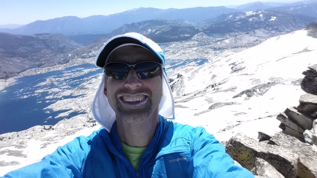
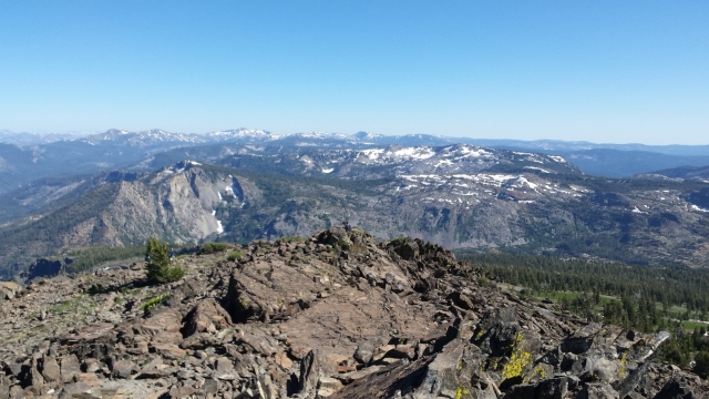
Getting to know Joe as we hiked up the ski hill towards Catherine’s Pass (at 10,400 feet, the high point of the course) I was blown away to learn that he was only 19 years old, and I think he was a bit taken aback when I told him I was  nearly 45. At some point I told him I would definitely buy him a beer, except that he was 19 and Mormon so that might not be a good idea. Eventually we reached the pass where you are supposed to kiss the sign; it was pitch black and we didn’t kiss it or take a picture but Wanderly Reis did so here it is:

Catherine's Pass
Catherine’s Pass – Photo by Wanderly Reis and/or his pacer

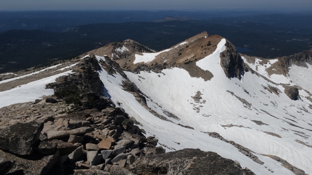
Heading down the other side of the pass things got a bit rough. My vision was blurry, my balance was a little off, I was bone tired, taking caffeine pills (leftover from some other adventure) every couple hours to stay awake, but they were expired and didn’t seem to have the potency I was hoping for. I wasn’t really able to run much at this point – I couldn’t see very well between the blurry vision and the dust, and the trails were really rocky, so slowing down to a power-hike was the only way I could avoid falling on my face. The toughest downhills on the course are in this section. The Glide didn’t seem so bad but the Plunge was just stupidly steep, rutted, and full of deep, loose, fine dusty sand. It was nearly impossible to stay upright, let alone run, and trying to keep the sand out of our shoes (and mouths and noses) was futile.

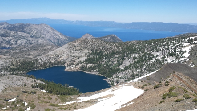
Thankfully this section ended at some point, and eventually we made it to the Pot Hollow Aid station (mile 84.5 – only about 15 miles to go!). At the aid station it was damp and bone-chillingly cold – even standing by the fire didn’t seem to help, so we headed out into the cold night, climbing up and up and up the seemingly endless hills. We neared the top of the ridge, and my spirits slowly rose along with the sun. The sunrise was pretty spectacular, or at least seemed that way to me…any sunrise would have been spectacular at that point.

IMG_7520
Sunrise

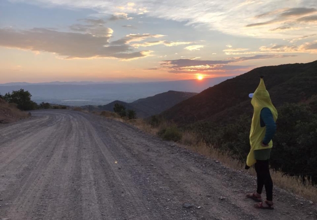
As dawn broke, Joe and I found ourselves on a section of fairly smooth, rolling dirt roads. At some point there may have been a banana on the trail, but after 26 hours or so things like that seem pretty normal.

Bananas
This Shit is Bananas…  [photo by Anthony Orig]

As we put the headlamps away I realized that I could see well again – the blurriness was gone – and I tentatively tried to run. Running was really hard but I managed a few painful yards and slowed to a walk again. Joe started taking selfies and smiling way too much.

IMG_7525

 I alternated running and walking, with Joe patiently matching my pace and occasionally running ahead to take a picture.

IMG_7528
I’m just trying to keep moving and not fall over

Gradually I was able to run longer and longer stretches between the walk breaks, and at some point we were running all the flat and downhill sections and even some of the uphills. My legs and lungs were slowly coming back to life!

IMG_7523
Approaching the 2nd to last aid station at about 7:12 am – only 10.2 miles to go!

We started to pass people again, after being passed by a whole bunch of runners during the long night. The last 10 miles I was running the downhills and flats at a 7-8 minute pace, even running some of the easier uphills, and feeling better than I had all night. It felt great to be running again, to be able to see clearly and move quickly, and pass people one after the other.

Joe and I got into a rhythm – I think he was surprised that I was able to run this well after seeing me struggle through the night, but we were both really happy to just be running again. It was painful, slow, and seemed like it would never end, but every step we ran brought us that much closer to the finish line, and running meant we would finish sooner; and so we ran.

The last 3 miles seemed to go on forever. The trail wound alongside a reservoir, fairly flat with gently rolling hills and the occasional short steeper section.

We passed more runners with their pacers, and I kept expecting to see the finish line every time we rounded a bend. Finally we left the reservoir and ran along a road for a while, and the park where the race ended came into view. Again I was grateful to have Joe as my pacer, as the markings were sparse and I might well have gotten lost on this last section without him.

We crossed the finish line at 9:09 am, after running for 28:09:20, for 37th place out of 313 starters and only 201 finishers.

image2.jpg

A handshake and hearty congratulations from the race director had me pretty much in tears – emotions tend to well up when you have dug down that deep for that long.

image5-e1511656516825.jpg

The race has a 36 hour cutoff so the awards ceremony wasn’t until 5pm – thankfully Tom had met us at the finish line and he lent me a sleeping bag and pad so I was able to nap off and on, between trips to the bathroom and the food tables. Since the finish line is about an hour’s drive from town, and I didn’t have a car, and Chris and Kat were now out of town for their anniversary,  I pretty much had to stay there till the awards ceremony or I probably would not have made it back. Thankfully there were showers there, so I was able to wash the grime off, which made a world of difference!

While waiting I chatted with a few runners I’d seen out on the course, their friends and families, etc. We all cheered other runners as they straggled across the finish line, looking progressively more beat as the day wore on. Finally 5pm came, the last finisher crossed the line, and we all collected our buckles and plaques and headed back to the city to resume our normal lives – a little tougher, and perhaps a little wiser for the experience. But without a doubt, we have all gained a deeper understanding of the official race slogan of the Wasatch 100:

“100 miles of  Heaven and Hell”

But as they say, suffering is temporary, and achievements last forever – so maybe it’s just Purgatory after all…

20170909_200833


20170909_200750

Strava Link: https://www.strava.com/activities/1178571599

***Special thanks to the race organizers and ESPECIALLY ALL THE VOLUNTEERS who make this race happen and make it fun! The aid station volunteers were 150% amazing all day and all night long!!!!***


Focused Training – and Coaching – pays off.

20170810_154311It has been a while since my last post – it has been a busy spring and summer in our house. My wife’s son Nick recently started college at UC Berkeley – he is living in the dorms, so we are technically empty-nesters and it has gotten a bit quieter around here in the last few weeks. So I’m catching up a bit now that I have more free time.

As mentioned in my last post, for most of 2017 I have been focusing on training for the Wasatch Front 100 Endurance Race. Initially I developed my own plan using Jason Koop’s book “Training Essentials for Ultrarunning” as a guide and incorporating interval training workouts for the first time in my running “career”. The intervals and more regular training definitely work – my speed improved, my ability to run up hills improved, and I was enjoying the added structure and feeling fitter than ever.

About 3 months before the race, I was talking to Adam White and he mentioned that he was considering hiring a coach (David Roche). My friend Jack Hsueh also had a coach for a while (Ann Trason) and in talking to him it sounded like he had gotten a lot out of the experience. This got me thinking about coaching more seriously and around the same time I got an email from CTS with a trial offer – first month free and $175/month after that for the basic level coaching. Since Koop is with CTS and I was already using their system, I decided to give CTS a try and got set up to work with John Fitzgerald, who has run Wasatch as well as a number of other 100 milers.

Having a coach for these 3 months was an interesting and worthwhile experience – I definitely learned a lot, was more focused and disciplined in my training, and my fitness continued to improve over just self-coaching using the book. John was great, his training plans kept me on target and training more consistently than I had been on my own. He kept in touch with me consistently through the summer, even when he was on the road attending races, getting married, moving, etc. He also helped me train and stay positive through a number of minor injuries that I had over the summer. On top of this, he was able to give me some very specific strategy advice since he had done the Wasatch 100 himself.

The training itself included lots of intervals – mostly uphill – from 3 minutes to 20-30 minutes at a time. There were also easy recovery days, and typically back to back long runs on the weekends with a 2-3 hour run followed by a 3-5 hour run the next day. I did some heat training in San Luis Obispo and on Mount Diablo in the last few weeks before Wasatch, but only managed to get up to Tuolumne once about a month before the race.

I was hoping to get up to the mountains more, but I had some recurring tendonitis in my hips, probably from running the downhills too hard too often. John’s advice was that it is better to be 100% healthy and 80% fit (or acclimated) than 80% healthy and 100% fit – and of course he was 100% right. So I had to cancel some trips to the mountains, which was frustrating, and I was not as acclimated to altitude as I would have liked. I wasn’t too worried about the altitude though, as the high point on the course is only about 10,400 feet and I seem to handle moderate altitude pretty well, even with minimal acclimatization.

In the end I got to the starting line as healthy and fit as I could have hoped to be, and mentally prepared for a tough 100 mile run in the Wasatch range. I’ll do a separate post about the race itself, which was quite an experience!

Here are some pics from my one trip to Tuolumne this summer – looking forward to getting up into the mountains more in the near future!

20170810_150110

20170810_132301

20170809_193710

20170809_193835_Richtone(HDR)

Training Time

I’ve never had a running coach or followed a real training plan for running. I did not run regularly or competitively in high school or college, and really only started trail running in 2010 to get ready for my first 50k. I went back to mostly climbing for a couple years, and then started trail running more again while training for the JMT in 2012-2014. I’ve done some short periods of pretty high mileage, but never did any interval or tempo workouts, or even ran 5-6 days a week for more than a few weeks at a time.

Mostly I trained by feel, went pretty hard when I did get out, tried to train as specifically as possible, and took lots of rest days instead of doing easy recovery runs. I’ve gotten reasonably good results from this approach (intensity works after all), but I think I’ve got a lot of room for improvement with a smarter, more disciplined approach.

So after another few months of  fairly sporadic training, I decided it is time to get serious, disciplined, and consistent. I also signed up for my first 100 mile race – the Wasatch 100 in September.  The Wasatch was actually my second choice – like many people, I tried and failed to get into the iconic and ultra-popular Western States 100, which is almost in my backyard.

I’m pretty excited about the Wasatch – with around 24K feet of gain, it is  one of the harder 100 mile races in the country. There is also a real possibility of both 100 degree temperatures during the day and snow/sleet/hail and 20 degree temps at night. Very few people finish in under 24 hours – it seems that 30-36 hours is much more common –  and about 1/3 don’t finish at all.   My goal right now is to finish in under 30 hours, and as close to 24 hours as possible.

Toward this end, I recently bought Jason Koop’s excellent book “Training Essentials for Ultrarunning” and spent a couple days reading and re-reading it. Then I put together a rough training plan for the next 7 months based on the principles he outlines. I’m less than a week into, it but so far I like having the additional structure and focus to my training for a change, and the short, hard interval workouts are a nice change of pace. As I’m a relative beginner when it comes to both racing ultras and consistent/focused training, I should have a lot of room to improve with the right training stimulus.

Basically the plan is 3-4 weeks of focusing on high intensity, uphill VO2Max intervals, followed by 8-12 weeks of Lactate Threshold intervals, and finally 8-12 weeks of high mileage, lower intensity endurance work. Each phase also includes easy recovery runs, and longer endurance runs, and a total of 6 days a week of running.

So, now I’ve got a goal and a plan, let’s see what I can do with it!


High Sierra Trail Eastbound FKT and Yo-Yo FKT

20160813_102147
Ready to go!

The 61-mile long High Sierra Trail has the unfortunate distinction of being both overshadowed by the John Muir Trail and frequently confused with the rugged and mainly off-trail Sierra High Route. It is quite a trail in its own right however, crossing the Southern Sierra Nevada from Crescent Meadows in Sequoia National Park to its terminus at the summit of Mount Whitney. While the scenery is exceptional by most standards, it does not quite measure up to the continually mind-blowing awesomeness and variety of the JMT, or the rugged alpine character of the SHR. However, compared to the JMT, the HST has the advantages of being less crowded, shorter, and easier to get a permit for. The High Sierra Trail actually joins the JMT at Wallace Creek for the final 11 miles to the summit of Mount Whitney, which is the only section of the HST that I had done prior to this trip.

Most people who backpack the HST seem to go from West to East, taking a few days to a week to cover the 72 miles (including the 11 mile descent from Mount Whitney to the trailhead at Whitney Portal which is not part of the “official” HST). This typically involves either a 300-mile car shuttle, or getting dropped off at the start and picked up at the end. For this reason, as well as its relatively short length, I decided it would be a fun challenge to do a Yo-Yo (ie round-trip) on the High Sierra Trail.

HST Profile
High Sierra trail Elevation Profile – generated by Sierra Mapper

The Yo-Yo approach eliminates both the car shuttle and the steep, crowded 11-mile descent on the Whitney Trail, leaving an aesthetic 122-mile double crossing of the Southern Sierra, with the mid-point being the highest point in the continental U.S.

According to the FKT website, a handful people including Leor Pantilat, Brett Maune, Brian Robinson and Peter Bakwin have run the HST from East to West, and at least one has tried a West to East run. Although she skipped the 4 mile section to the summit of Mount Whitney, Sarah’s Thompson’s time of 23:05 going West to East (the harder direction) is still impressive. Leor’s very fast time of 15:46 from Whitney Portal to Crescent Meadows is the current FKT, while Brett’s previous FKT of 18:39 seemed like a more reasonable approximation of what might be possible for me on a one way trip.

There were no reported round trip times in either direction, but I estimated that it would take me about 36-40 hours, if all went well. While perhaps a bit optimistic, this was right at the limit of what I thought I could do without sleep, so hiking through the night instead of carrying camping gear and stopping to sleep seemed like a no-brainer – as long as the weather was stable. As an added bonus, since I would be hiking in both directions, any scenery that I missed in the dark I would see in the daylight on the return trip, and vice versa – and if I timed it right, I could see the sunrise from the summit of Mount Whitney at the halfway point. Also, since I would not be “camping” I would not have to worry about getting a wilderness permit or carrying a bear canister.

Given all this, I could hardly believe that no one had done it already – or if someone has they did not report it on the FKT website. Regardless, I decided to go for it, when the time and the weather forecast were right. And so it was that I found myself packing for another solo trip to the mountains.

I drove to Sequoia the afternoon of Friday August 12, and managed to get the second to last campsite in the park. I got a good 10 hours of sleep and woke up at 6:30, planning to start between 8:30-9:30 am, hoping to arrive at the summit of Mount whitney around 6:30am for sunrise. I had a big breakfast, packed up my camp and tried to drive to the Crescent Meadows trailhead, only to find that the road is closed on weekends and you have to take a shuttle bus to the trailhead. However, if you have a wilderness permit you can park at the trailhead.

So I had to drive back to the permit office at Lodgepole, and explain my rather unconventional trip plan to the ranger, in order to get an overnight wilderness permit for my dayhike, all so I could drive to the trailhead and my car would be waiting for me there when I finished my epic in the middle of the night.

I told the ranger I was going to Wallace Creek, and would either turn around there, or go all the way to Whitney and back if I was feeling good. This was all true – my backup plan was to turn around at Wallace Creek or any point along the way if things were not going as planned, and I knew that I could bail at Whitney Portal if necessary. Realizing the mileage involved, the ranger seemed a bit skeptical, but his main concern was that I would not leave any food wrappers on the trail – he mentioned that they have had problems with runners leaving trash behind.  I assured him that I am always super careful to pack out my trash, and he issued the permit.

As a result of all this, I didn’t start till 10:30 am. I planned to be out for 36-40 hours and brought enough food to have 200 calories per hour for 37 hours – about 24 Clif shot blocks with a bunch of Clif and Honey Stinger gels and 4 Lara bars, or 7400 calories total. With rain jacket and pants, hat, gloves, phone, map, 1L water and a few other odds and ends my Ultimate Direction AK running pack weighed about 10 lbs starting out.

The first 11 miles or so to the Bearpaw Meadow High Sierra Camp was very dry and dusty, rolling and fairly easy trail, and I enjoyed running quite a bit of it at an easy pace, trying to conserve energy while covering the easy miles as quickly as possible. I reached Bearpaw Meadow at mile 11 feeling good. A few miles later I reached Hamilton lakes and started climbing up towards Kaweah gap. The scenery started getting good and the climbing felt easy with my light pack. I started passing backpackers and eventually reached the beautiful Precipice Lake, which I instantly recognized from Leor’s pictures.

Before I knew it I was at Kaweah Gap, 20 miles in and only 100 miles to go. I checked my watch and the elapsed time was 5:38. This may seem like an overly fast pace, and it may have been, but I knew that when it got dark I would slow down quite a bit and I wanted to cover as much ground in the daylight as possible.

Somewhere along the way I started feeling a hotspot on the ball of my left foot. I stopped to check it and realized that it was not a blister, but so much fine dust had gotten through my gaiters, shoes, and 2 pairs of socks that my feet were black and the dust had accumulated under my foot and was slowly rubbing it raw. I cleaned up as best I could and put a second skin bandage on it and continued. Over the next few hours I had to stop numerous times for foot care due to the amount of dust that was getting into my shoes. I used up most of my blister care supplies in an effort to prevent minor issues from becoming major ones, realizing a bit too late that I should have brought a fresh roll of Leukotape. The small roll I have had in my blister kit for a year or more had degraded to a useless, sticky mess. Fortunately I also had a few scraps of kinesiotape which was just enough to do the trick.

From this point on, the amount of running I was able to do was quite limited – I was pretty sure that if I ran much I would end up with bad blisters before the halfway point, and may not be able to finish. My primary goal was to finish the HST Yo-Yo – time goals were secondary and I did not want to make any mistakes that would force me to bail or make finishing more painful than necessary. And anyway it was going to be getting dark soon, so I resigned myself to a fast hiking pace for the foreseeable future.

I’m guessing that since I was only carrying a daypack, I was running more than I usually do on my long efforts, which kicked up more dust than usual. I’ve spent a lot of time on the JMT, which is also a fairly dusty trail, but this seemed quite a bit worse than usual. If I was going to do this trail again I would seriously consider drastic measures to keep the dust out as that was definitely the limiting factor.

gaiters.jpg
I want this guy’s gaiters.

It got dark as I was nearing the Lower Kern Canyon Junction at Funston Meadow (mile 35, elapsed time 10:09). Only 25 miles to go to Whitney, and then another 60 to get back to the start! I hiked up through Kern Canyon in the dark, thankful that it was cool but thinking that it would have been nice to be able to see it in the daylight and perhaps run some of the smooth, relatively flat trail through this reportedly very nice section. But no matter, I would be back soon enough in full daylight!

20160813_203938
The time is correct but the mileage on the watch is short due the GPS tracking at 1 minute intervals to save battery life. Actual mileage at this point is about 35, only 25 miles to go to Mount whitney and then only 60 more to get back!

I reached Wallace Creek at around mile 49, elapsed time 14:54 and was elated to realize that I had less than 12 miles to go. I felt good enough to continue, so off I went.

20160814_012403

I reached Crabtree – still in the dark of course – (mile 53, elapsed time unknown) and continued on. As I neared Guitar lake I saw the familiar line of headlamps making their way up the backside of Whitney – the convergence of JMT hikers finishing their 2-4 week treks and Whitney hikers, all trudging their way up to see the sunrise from the highest point in the lower 48. It was just staring to get light as I reached Trail Crest, and it was cold enough that I put on my rain jacket and vest, and soon stopped again to put on my rain pants. I was now wearing all the clothing I had (including hat and gloves), hiking fast uphill, and still a bit cold. It is chilly up there at dawn!

As I passed by the first windows down to the east side, I caught a few glimpses of the sunrise, but by the time I reached the summit the spectacle was over and day had broken. I had missed sunrise on the summit by about 15 minutes!

20160814_064655
Better late than never!
20160814_064907
Not my best look, but I had been up for 24 hours and moving for 20 hours and 60 miles!

Not wanting to make a spectacle of myself, I only mentioned what I was doing if someone asked, so most of the people on the summit likely assumed I was just another dayhiker. The few people I told what I was doing had a hard time comprehending, which is to be expected – I still wasn’t sure how or if I was going to be able to finish this thing, but I was at the halfway point, feeling pretty good overall, and it was daylight again, so I had a few things going for me! Elapsed time on arrival at Whitney summit was 20:06 (10:30 am to 6:36 am) and I stayed there for 20 minutes, heading back down at 6:56am.

I stopped at one of the Tarns above guitar lake to take care of my feet, and used up the last of my blister prevention/treatment supplies. As it turns out this was the last time I took off my shoes as well, but I did have some decent sized blisters by the end of the hike. I figured there wasn’t much I could do to stop them at this point so I just popped 3 ibuprofen every 6 hours and pushed on.

20160814_084818
I like to think of this as Whale Rock

By the time I reached the Kern Canyon again it was midday and kind of a furnace, or it would have been quite pleasant.  I eventually remembered to dip my hat in the streams and get my hair wet, which helped cool me down a bit. Periodically I passed some backpackers; most didn’t ask questions beyond the usual “how’s it going” but I got some interesting looks as they tried to figure out what the hell I was doing so far out there with such a tiny pack. I still felt surprisingly good at this point considering I was about 80 miles in with 40 more to go, although the heat was definitely taking a toll. I am not sure of the time or exact location here but it was probably in the 28-30 hour range.

20160814_121537

20160814_121530
This must have been on the way down into Kern Canyon, or on the way back up out of it. It is all kind of a blur at this point.

Eventually I passed the Kern Hot Springs (I had missed it in the dark on the way in) and thought about stopping for a dip. At this point I was so hot that the cold river sounded a lot better, but with 37 miles to go I didn’t want to take the time to stop and take my shoes off, so I kept going. All my focus now was on getting back to the car, real food, sleep, clean clothes.

It started to cool down, the pressure dropped, and a restless wind bounced around the canyon. The huge trees around me were suddenly swaying and groaning, and a pine cone with a tuft of needles still attached landed at my feet. I was reminded of the many dead branches and dead trees swaying high above me, just waiting for the right push from the wind to let go and come crashing down to earth.

The storm alarm on my watch started beeping insistently. I examined the sky and saw a few clouds behind me to the north, and clear blue sky everywhere else. It didn’t look like a storm was coming, and in my state I sure hoped it wasn’t – but it was a bit disconcerting to say the least. Fortunately the wind soon died down and I headed up and out of Kern Canyon, thankful for the breeze and the slightly cooler temperatures.

I wanted to get as far as I could in the daylight before darkness and sleep deprivation joined forces to throw me off course – I knew it could get ugly real quick and the longer I was out here the more likely I would be to get lost or screw up in any number of other ways. So I doggedly plodded up out of Kern Canyon and onto the Chagoopa Plateau in the evening light. It was dark well before I reached Kaweah gap, but I knew once I got there I had only 20 miles to go. It didn’t really register that I had just hiked 100 miles in one push – all my focus was now on staying upright, and continuing to move forward.

Once it was dark my balance started to go. I found that when I turned my head to look at something, I would get a little dizzy when I turned back and have to stop to keep from falling over. As much of this section is on a trail that is less than 3 feet wide, with a huge dropoff on one side, I tried to focus on staying right, and not falling off the cliff on the left.

This was all familiar and expected after my JMT efforts last year, so I didn’t worry too much, just tried to stay focused on the trail and not to look around more than necessary. This is harder than it sounds. Rocks look like tents, trees look like people, all sorts of animals make noises in the woods, and in the dark there is a constant desire to look around and get your bearings. At one point a bird flew out of a bush as I brushed past and flapped and squawked angrily at my head, defending it home from the unbalanced intruder who had the nerve to disturb its home. I ignored it and kept moving.

Heading down past Precipice Lake towards Hamilton Lakes, I started having some serious thoughts about rocks. I literally remembered nothing about this section of trail, and could not believe how many rocks there were. In my mind for hours I had been envisioning a smooth if somewhat dusty last 20 miles back to the car. I remember thinking that there were just too many rocks, they looked like all the other rocks I had already been over and I had already seen quite enough rocks and I did not order these rocks! Still the rocks just kept coming. I was so sick of stepping over, on, and around these pointy, unbalanced, poorly arranged rocks with my battered, blistered, and tired feet.

I also had periodic episodes where I would forget why my feet had to keep stepping on the rocks, it seemed there had to be a better way and it all seemed so pointless and interminable. And yet the rocks continued. My knees hurt, my feet hurt – oh yeah, it must be time for ibuprofen again. My food supply was starting to run low so I switched from eating every 30 minutes to every 45-60 minutes. I started checking the map more often to make sure I did not get lost and knew where the next water would be. The trail seemed to go on forever, but eventually I reached Bearpaw meadow and filled up both my bottles for the final 11 mile stretch. This also went on forever. Every little hill was a struggle – and there were LOTS of little hills. The trail at this point is pasted on to a steep hillside/cliff and goes up and down over and over again as it winds in and out of innumerable side canyons.

Sometime around 4am my headlamp battery died suddenly (this was battery #2 so I was glad I had decided to bring battery #3 at the last minute). I changed it in the light of the moon and continued on. I saw a smallish bear on the hillside above me foraging for food, and decided that this was a good omen.

Around 5:30am it started to get light in the forest and the birds woke up and began making cheerful noises, which lifted my spirits a bit. I turned off the headlamp and put it away. I had now hiked through two full nights, and dawn was here again. I had to be close but the trail just kept going on and on. I was now checking my GPS app on my phone compulsively to make sure I was still on the right trail. I was, but it simply refused to end. Eventually I got to Eagle View and realized with both both horror and relief that I had one more mile to go.

20160815_062052
Eagle View – if it wasn’t so blurry you could see that the rock behind me looks like an Eagle. only 1 mile to go!
20160815_063508
All done!! Not looking too bad after 44 hours and 122 miles…not much worse than usual anyway!

Then it was over and I had to decide whether to eat, sleep or shower first, and where and how and in what order. I managed to drive to Lodgepole without crashing, took my shoes and filthy clothes off, examined my swollen feet, got some food and a shower, found a place to sleep for a few hours and then drove home. All told I was awake for 54 hours straight, moving more or less continuously for about 44 hours, covering 122 miles and approximately 28,000 feet of ascent and another 28,000 feet of descent.

My times were as follows:

Crescent Meadows to Whitney Summit: 10:30AM to 6:36 AM (20:06)

20 min spent on Whitney Summit

Whitney Summit to Crescent Meadows: 6:56AM to 6:32 AM (23:36)

Total time 44:02

I believe this is an FKT for both the Crescent Meadows to Whitney segment as well as the full Yo-Yo.

It was a grand adventure, and one that I will not be repeating anytime soon.

Gear:

  • Ultimate Direction AK pack with 2 UD body bottles (worked great, highly recommend)
  • BD distance carbon poles
  • Altra Olympus 2.0 shoes
  • Injinji toesocks plus farm to feet wool socks
  • Dirty Girl gaiters
  • CEP calf sleeves
  • Nike running shorts
  • Patagonia Capilene 1 long sleeve shirt
  • Ultimate Direction sun hat
  • Montane Pullover rain jacket
  • Homemade synthetic vest
  • Patagonia Alpine Houdini rain pants
  • Mountain Hardwear powerstretch beanie
  • OR warm running gloves
  • OR fingerless sun gloves
  • Zebralight headlamp with 3 CR123 batteries
  • Ibuprofen, caffeine pills, salt tablets, 2 starbucks via packets
  • lip balm and sunscreen
  • small blister kit
  • TP and ziplock baggies
  • Phone with US Topo GPS app (not the best app but it works)
  • Paper Map
  • Suunto Ambit3 Peak GPS watch
  • Food – 24 packages of clif shot blocks, 4 lara bars, and about 18 gel packets (consumed all but 3 of the lara bars)

GPS track:

[edit 12/4/2016: Original GPX files were sent to Peter Bakwin and Adam White for verification etc shortly after this trip. Adam combined the two files into one GPX file and using programming magic, added data points exactly halfway between each existing data point in both time and space, in order to increase the accuracy of the Strava data for per mile pace etc as it was wildly inaccurate in the original files due to the 1 minute GPS sampling rate I used in order to preserve battery life on my GPS watch.]

https://www.strava.com/activities/793562376

Desolation Wilderness 6 Summits – July 4, 2016

20160705_092150
A taste of what was to come…

So about a month ago I set out to do the Desolation 7 Summits Bay-to-Bay in a Day. I got up at 2am, had a quick shower and breakfast, drove to the Ralston Peak trailhead (about a 2.5 hour drive), and got ready to roll. During the final packing procedures, I made the call to bring the ice axe and microspikes to make sure I would not get shut down by snow. I then ran down Highway 50 dodging speeding cars and tractor trailers in what I hoped would be the most dangerous part of my day.

After a mile or two of this, I started up what I thought was the Rocky Creek Trail towards Pyramid Peak. As it turned out, I had missed the trail entirely and ended up bushwacking up a steep, rocky, manzanita-covered hill for an hour or two before eventually finding the trail on the final ascent to Pyramid, my first summit of the day.

Nice summit blocks!

20160705_093753

From there I mostly stayed high and followed the talus/scree-covered ridge line to Agassiz and Price, as there was quite a bit of snow on the slabs below. I think most people descend to the slabs for easier travel here, and I did go down in one or two spots but didn’t stay down long. I ended up going under the snow briefly here:

20160705_094934
Don’t go in there!!!!

The travel was a bit slow/arduous but the views off both sides of the ridge line were stunning!

20160705_09380120160705_105815

20160705_105921
Why I stayed high

On reaching the summit of Price it took a bit of time to find the best way off the ridge down towards Mosquito Pass at the top of Lake Aloha.

20160705_112546
Not this way!

A bit of easy down-climbing eventually got me down to the snow, at which point I took out my ice axe and microspikes and descended the soft snow via a combination of downclimbing, plunge-stepping, and some pretty fun glissading. The spikes were probably not necessary, but the snow was steep enough that I was glad to have the ice axe to control my glissade speed. There were also multiple convex drop-offs ending in rocks that I did not particularly want to meet at high speed.

20160705_113326
Steeper than it looks and a long way down to the lake.

Eventually I got off the snow and reached the discontinuous slabs that descend to Mosquito pass. Here I met the first people I had seen all day, a group day-hiking with their dog from a campsite somewhere nearby, who were in the middle of a snowball fight. We chatted briefly and I headed up the long, loose scree slope towards Jack’s peak.

I crossed some snowfields on the way up, which was a relief as they didn’t slide like the scree. Eventually I reached the summit via a loose, sliding scree chute that I was happy to be out of as soon as possible.

20160705_134757
Someone shattered a whole lot of rock and dumped it up here.

20160705_134804

The traverse from Jacks to Dick’s peak was more scree/talus hopping but much more stable and went without incident. From the summit of Dick’s there is a loose gully followed by a long scree field with a faint trail that leads to Dick’s Pass, where I got engaged to Amy in the moonlight, about 3 years ago. It’s a pretty cool spot and there was more snow this time.

20160705_134826
Not sure what we’re seeing here, but it sure is pretty

On reaching the trail at Dick’s pass, I was happy to be done with the talus and managed to do some running down the trail towards Gilmore lake. I was starting to feel the weigh of the axe and spikes in my pack at this point, and knew I had quite a few miles to go yet.

I filled up my water for the first time at Gilmore lake, while a bunch of college students frolicked on the shore near their campsite. From there I headed up the trail towards Mount Tallac – the only summit of the day that I had actually been on before. I have skied up and down Tallac a handful of times over the years, always from the Lake Tahoe side, so I was on new terrain coming up the west side through grasses and flowers instead of snow.

20160705_165632
I skied this a few months ago!


20160705_143622
Tallac Summit view

It was beautiful, the trail was a bit wet in spots but overall in good shape, and the views of lake Tahoe from the summit were stunning as usual.

20160705_165553
Lake Tahoe with Emerald Bay and Fallen Leaf Lake from the summit of Tallac

Coming back down the trail from Tallac, I realized I would be racing the daylight and tried to run as much as my tired legs would allow, which wasn’t a whole lot. The extra weight of the ice axe and microspikes in my new UD AK adventure running pack weren’t helping matters, but I eventually made it back down to Gilmore lake and then to Lake Aloha after passing Suzie and Heather Lakes.

20160705_180449
Trees, mountains, lake, grass, rocks, and god rays.
20160705_182656
This reminds me of a pirate island
20160705_165610
Gilmore lake and the Pyramid-Agassiz-Price Ridge plus Jack’s peak from Tallac
20160705_165606
This one shows Dick’s Peak as well at center right ( I think)

As I hiked down the shore of Lake Aloha, the trail signs were less than clear and I ended up missing a turn that would have taken me on the most direct route towards Ralston peak and the trailhead where I had parked my car. I realized my error pretty quickly (using both a paper map and quick GPS check on my phone); but rather than backtrack I decided to take the slightly longer route via Lake of the Woods since I had never been there. I eventually reached the Ralston Peak Spur trail just as it was about to get dark.

20160705_203615
Lake Aloha sunset

It is only about a half mile each way to the peak on the spur trail, but I had a few more miles of unfamiliar descent back to the car so I opted to skip Ralston and do as much of the descent in the daylight as possible. As it turned out, the descent trail was easy to follow even in the dark, so next time I would opt to tag the Ralston summit as well for the full Desolation 7.

GPS route here (watch died at Lake Aloha so the route is incomplete): Strava Link

Total time was about 15+ hours of bushwacking, hiking, scrambling, running, navigating, and traversing some amazing ridges over an absolutely ridiculous quantity of talus/scree/choss. Five hours of driving, with about 5 cups of coffee to wake me up on the drive up and then keep me awake on the drive home. It was a bit early for the traverse due to the amount of snow still present, but it definitely made for spectacular views and a very alpine feel.

Thanks to Leor Pantilat for the inspiration (and for making it OK to skip Ralston on the first try). Also thanks to my good friends Dan Krotz, Brian Zeitler, and Jon Brooks, for doing it first and sharing some beta although I likely forgot all of it before actually getting up there. This was one I have been meaning to do for a while and it was a good one!

More pictures:

20160705_09375920160705_10582120160705_10583020160705_10584520160705_10590920160705_10592720160705_10593020160705_10593920160705_10594820160705_10595020160705_11000820160705_11001420160705_11231720160705_11232120160705_11332220160705_11333020160705_11335020160705_11335520160705_11340420160705_11340720160705_11342420160705_11350620160705_11351020160705_13490420160705_14360020160705_14360520160705_14362620160705_16561320160705_18045220160705_184805


Full Circle on the Skyline to Sea Trail

The Skyline to Sea trail is pretty special. As its name implies, it starts at the top of the coastal range at Saratoga Gap, and rolls gently through the gorgeous forests of Big Basin Redwoods national park on its way to a picturesque finish at the Pacific Ocean. Below are a few gorgeous pictures from David Baselt’s page that give a nice feel for what this trail is like:

Skyline redwoodsskyline startskyline roadskyline end

The trail is quite popular for backpackers, as it is beautiful, convenient to most locations in the bay area, has smooth trails and plentiful shade, and is overall a fairly easy 2-3 day trip suitable for beginner backpackers, families with children, etc. It is used by many as a training or shakeout trip to test their gear and fitness prior to longer trips in Yosemite or other wilderness areas. It is typically done as a one way trip with a car shuttle, over 2-3 days – and in fact Amy and I backpacked this trail in 2009 as our first backpacking trip together. We packed light and ended up running many of the downhill sections, partly for fun and partly because we had less than a day and a half to finish. Somewhere along the way, I decided it would be more fun to just run the whole thing in one day without carrying overnight gear.

Map:

skyline map

So the following year, (2010) I signed up for the Skyline to sea 50k trail race. I trained for about 2 months but as this was my first race and I really had no idea what I was doing, I was somewhat underprepared. I think my longest run in training was about 15 miles. When the race came, I ran a strong first half, enjoying the long downhills and pushing perhaps a bit too hard given my inexperience. I had forgotten my watch so I had no idea what my time or pace was, but I think for the first half of the race I was running fairly close to the front of the pack.

At about the halfway point in the trail, there is an additional 5 mile loop that turns the Marathon into a 50k (31 miles). I had decided to run the 50K so I headed out on this loop which grinds up a long steep hill to an exposed ridge, and eventually brings you back to the same point on the course where you left the main trail. It was on this loop that things started to go downhill for me. My legs were starting to cramp up and I had to stop to stretch them out a number of times. People started passing me. I had to slow my pace and walk a lot more than I planned. By the time I got back on the main course, I was cooked. My legs were now cramping every time I tried to run, so I was reduced to a fast walk with occasional attempts to jog down a slight incline. I started getting passed, first by the faster runners I had been seeing all day, and then by others I had not seen since the start. There must have been 30-50 people who passed me in the last 10 miles.

At some point a kind woman gave me a few salt tablets, which I had no idea people used to prevent cramping – and it was too late at that point to make much difference. As I approached the last aid station, I was dehydrated, my legs were destroyed, and my whirlwind of exhilaration had rapidly turned into a whirlpool of despair. Instead of flying down hills, I was now reduced to walking just fast enough that my thighs would not completely lock up. Running was no longer an option. I had run out of water miles before, and my quads and hamstrings were both on the verge of complete tetany. I had never pushed my legs like this before, and they were in full revolt.

The last aid station is only 3 miles from the finish line, but a full 10 miles after the previous one. When I reached it they had run out of both food and water – all they had left were a few cans of mountain dew. I sat down for the first time and chugged an entire can. After a few minutes I got up and shuffled on. Slightly rejuvenated after the sugar/water/caffeine infusion, I was able to intermittently walk and run the final 3 miles to the finish line, and even passed a woman who was struggling just like I was. As I approached the finish line, I was overcome with a surge of emotions, and the tears started flowing freely.

In spite of inexperience and numerous mistakes, I had managed to finish 71st out of 191 with a respectable time of 5:42:12 for my first 50k and first organized race of any sort. I was basically unable to walk for the next week, but the joy of flying down the trails and the sense of accomplishment made it all worthwhile.

Fast forward to 2016, with a few more races and adventure runs under my belt, and I came back for another run on the Skyline to Sea Trail. This time I decided to do the Marathon, as I had never actually run a Marathon before and besides, it seems like the natural “directissima” way to run this trail, rather than artificially making it longer and harder by adding an arbitrary loop up and down a huge hill in the middle of the course.

This time Amy and my friend Nico were also running the Marathon, and my friends Bryan and Jennifer Zeitler were running the 50k. Nico and I started near the front of the pack, and I kept a fast pace on the smooth rolling downhill sections, as I knew I would be hiking some of the hills later on. I was in much better shape this time, feeling strong but pacing myself so I would be able to finish strong as well. Nico took the start a bit slower – he prefers a more consistent pace as he runs up the hills and takes the downhills a bit slower.

Soon I left Nico behind, and as I crossed a road a few miles in, a volunteer told me I was in about 10th place – right where I wanted to be. I was hoping to finish in under 4 hours, which based on the last few year’s results should be good for anywhere between a 3rd and 12th place finish. The course plays to my strengths, with only  2500′ of climbing and a full 4000′ of descending on smooth, fast trails. I’m not the fastest on the climbs but I can usually make it up on the descents. And of course, this is a smaller race, so the competition was not as strong as in some of the larger races that attract lots of sponsored professional runners.

I stuck to my strategy of running the smaller hills and hiking the big ones, and making up time on the downhills. As I hiked up the largest hill, near the middle of the course, Nico and a woman he was running with both passed me – but I kept them in sight. Reaching the top of the hill I felt rested and strong, and soon I was passing them and a few other runners, as I settled into my downhill pace. I was about halfway done with the race and it was mostly downhill from here, with just a few small climbs to go.

Elevation profile:

Skyline to sea profile

On the second half of the course I occasionally passed someone but didn’t see many runners. The 50k runners were off doing their ridiculous extra loop and I must have been near the front of the Marathon pack. About 5 miles from the finish the singletrack trail turns into a fire road and I started to see people hiking, riding bikes and even horses. I passed a few backpackers and weirdly saw Erica Namba hiking up with a friend – I knew Erica from climbing at Berkeley Ironworks, and we actually carpooled to the race together in 2010 (she finished way ahead of me). Sometime after that she started dating Leor Pantilat, and in 2013 I ran into Erica and Leor at Road’s end as I got ready to “run” the Rae Lakes Loop and they were starting an adventure run of their own to some nearby peaks. Seeing a familiar face gave me a small boost, and I was happy to still be running and feeling pretty good.

A few minutes later, an equestrian informed me that I was in 4th place, so I immediately picked up the pace, thinking I might have a chance at 3rd place if I pushed it. Out of the blue I was passed by a guy going so fast he could not possibly be in the race. I found out later that he was the first place 50k runner, but at the time I assumed he must have been out for a solo 5-6 mile run – he had no bottle and I didn’t see his race bib and he was running what seemed more like a 10k pace than a 50k or marathon pace. I was running 9-10 minute miles at this point and he passed me like I was standing still. I never caught the 3rd place runner, but I did manage to finish in 3:47:37, 4th overall for the marathon, 3rd male, and 1st in my age group. So technically I had my first ever podium finish, in my first marathon!

Nico finished right behind me just a few minutes later, and it was fun hanging out at the finish line with him, talking about the race and cheering for all the other runners as they finished. Eventually Nico had to head home, but soon enough Brian and Amy and Jennifer finished their races, and we all celebrated a day well spent on the Skyline to Sea trail. I was ecstatic with my performance, especially as compared with my epic meltdown 6 years prior – and it was all the more special sharing it with Amy and a few good friends.

It was truly a special day for me – running full circle on the best point-to-point trail in the bay area.

20160612_171449


20160612_171253

Miwok 100K – May 7, 2016

Miwok Photo1The Miwok 100k is an iconic trail race in the Marin Headlands. For me, Marin is a great place to race – and of the few races I have done, half of them have been in Marin. I love running in the Marin Headlands for a few reasons: The trails are generally smooth and well graded, the views are amazing, it is generally cool with a nice sea breeze, the hills are large and plentiful, and the scenery varies dramatically from lush forest with ferns and moss to rugged sea cliffs and manzanita. The Miwok follows some of the same trails as the North Face 50 mile race that I did in December, but is 12 miles longer and has much more history and personality.

On this particular day, I was feeling strong and well trained, and while I didn’t want to go out too hard I also didn’t want to get stuck behind a bunch of slow people going up the infamous Dipsea trail. So I made my way to the front of the pack just before the start, and ran with a fast group of 5 or 6 for the first few miles up to the Cardiac aid station. Arriving with the dawn to the sound of bagpipes piercing the fog and mist was an unexpectedly magical experience.

I ran a smart but aggressive pace, running more of the hills than I usually do but saving some energy for the second half. As I approached the confusing junction near the Bobcat trail I was very happy to see my good friend Brian Daly directing traffic, keeping the runners on track. Brian was injured this year but has run Miwok a number of times in the past and was volunteering instead of running this one. It gave me a nice boost to see a friendly face on the trail and I cruised down towards the next aid station.

Miwok1

As I reached Tennessee Valley for the second time at mile 26, I realized I had just run one of my fastest Marathon times and was still feeling good with “only” 36 miles to go. I changed into a dry shirt, evaluated the sky, left my rain jacket in my drop bag, and pressed on. Leaving Muir Beach, at about the halfway point, I was passed by Bree Lambert, who ended up finishing 2nd Female and 21st overall. Apparently she’s kind of a big deal but I was strategically hiking up the hills to save energy, so I let her go.

Right as I topped out at Cardiac, at mile 35.5, the weather turned from sunny to blowing cold wind and rain. I put on my Houdini wind jacket (definitely not waterproof) and pressed on. I was surprised how many runners had no jacket; the weather forecast was unstable and when it turned it got pretty uncomfortable for those with no protection. There were lots of people running with just a T-shirt or Sports Bra – or no shirt at all – and looking pretty miserable.  It was wet and windy for the rest of the race – apparently a lot of people dropped due to the weather and/or inadequate clothing. With my jacket on, I was wet but warm, which made a huge difference.

After the second pass through Cardiac, the race was basically a muddy, wet, and windy 14 miles out to Bolinas Ridge and the Randall turnaround, followed by 13 miles back to Bolinas and then down to the finishe line at Stinson Beach. It was windy and rainy nearly the entire time, although the rain did let up as I approached the lower elevation section near the Randall aid station turnaround. With my shoes (and everything else) already soaked, I ran through numerous puddles that were 6 inches deep, and 20-50 feet long, covering the entire trail.  It was kind of fun to just plow through the mud and water rather than try to stay dry.

Coming down the long windy hill to the Randall turnaround, the rain stopped and the trail was smooth and fast. This was probably my favorite section of the course and I flew down it, grateful for the respite from the wind and rain and mud.


As I was changing into a dry shirt at Randall I heard a familiar voice – Nico Raffo was there waiting to pace his friend on the last 13 miles and he was telling me how great I was doing – this was another nice pick-me-up! I felt good after the long cruiser downhill and took off hiking fast up the hill back towards Bolinas. Shortly I was passed by Nico and his friend, but I kept to my strategy of hiking the big hills and going harder on the downs.

My strategy seemed to work, as I started passing people on the rolling hills going back into Bolinas. Unfortunately I had to stop to poop there – so I lost a few minutes at the aid station porta-potty. I then re-passed a few runners on the way back towards Stinson Beach, which confused a couple of them. Eventually I passed Nico and his friend, as well as a few more runners on the long, fun, final downhill to Stinson Beach.

Miwok5Miwok Photo 2

In the end I finished in 11:33:22, for 44th place out of 288 finishers. I think there were about 400 people who started but quite a few dropped due to the weather conditions. This was my best race experience so far – in addition to the amazing course and scenery, it was well organized and well marked, and I had probably my best race performance to date. It was fun to push hard and have to deal with some adverse weather conditions, but I was well prepared, ran a smart race, and managed to stay warm and in control. My friend Jack Hsueh did well also, finishing in just over 12 hours. It was great to hang out at the finish line with Jack, Brian, Nico and a few other friendly faces. I’m not sure if I’ll do this race again,  but I would highly recommend it due to the amazing course and excellent organization.

Extreme Trail Running (from the archives)

ice
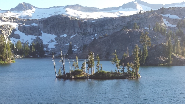
Our camera froze so no pictures survived, but it was pretty much just like this.

This was 6 years ago today, but the memory still haunts me. We will never be the same, after this near death experience at Rodeo Beach.

We ran for 2+ hours in gradually worsening conditions. Dan’s fashionable running shorts unfortunately proved inadequate for the wind, driving rain, and near freezing temperatures. We were forced to abandon our grandiose plans for a massive ridge traverse linkup as the hurricane force winds threatened to blow us off the ridge, pelting us with freezing rain and spindrift.

Once we gained the main ridge, every exposed surface of our bodies was soon coated with rime ice, inhibiting limb function, while the wind began picking us up and tossing us about like rag dolls. With heavy hearts and beards thick with ice, we reluctantly headed down in a desperate bid for survival. Disappointment and desperation set in when we were unable to locate the high camp the Austrian team had abandoned back in ’75, when 2 members of their party perished.

Dan bravely soldiered on in spite of quickly worsening symptoms of frostbite and severe hypothermia. Meanwhile, I was suffering from the worst case of Low-Altitude Pulmonary Edema (LAPE) either of us had ever seen. However, I selflessly offered Dan my extra hat, enabling him to retain enough heat that his limbs continued to somehow function, and he regaled me with off-color jokes about the disastrous Austrian ascent, enabling me to cough up the worst of the sputum. We rapidly descended the french col, and my coughing subsided with the dramatic change in altitude from 400′ to 150′. After sucking down another Mocha Clif Shot with 25 mg caffeine, we somehow mustered enough energy to continue.

And so it was that, in continually worsening conditions, now soaked to the bone, completely and utterly exhausted from our 2 hour and 18 minute ordeal, we staggered back to the car, heroically and miraculously completing our self-rescue. More than anything, we were thankful to be alive, and glad we had once again escaped the cruel grasp of the reaper. Also, we were happy to have avoided the horrible choice that we would have had to make, had we been out there in those conditions any longer: certain death at the hands of this cruel spring storm, or summoning the courage to ask a middle-aged woman race-walking in capris  if we could use her cellphone to call for help.

TNF 50 Mile, Marin Headlands – December 5, 2015

I don’t always pay good money to run 50 miles. But when I do it is in Marin and it is awesome. My average speed on this one was was 5.8659 mph, which for me was pretty fast.

My target average speed with overnight gear on the JMT is about 3mph. I’ve actually hiked/run every step of the JMT more times (5 or 6, I’ve kind of lost count) than I’ve paid to run an ultramarathon race (exactly 3). I’ve actually never run an official Marathon – that would be too conventional I guess.

My first Ultra was the Skyline to Sea 50K in 2010, which I finished in about 5:42 despite massive leg cramps that forced me to walk much of the last 5-10 miles. (This works out to about 5.44 MPH). I had no idea what I was doing – I went out hard and fast, bombed the downhills, and hiked the uphills so my knees wouldn’t blow up. I think my longest run before that was about 16 miles. I learned about salt tablets at about mile 25 from a passing woman who was nice enough to share a couple with me. At that point I could barely walk -my hamstrings and quads were so locked up, bending my knees was not really an option. A lot of people (maybe 50? I’m not sure) passed me in the last 5 miles, which was all easy downhill. This was frustrating,  but my exuberant start still placed me at a respectable 71st out of 191.  It’s kind of crazy to think how well I could have done had I not blown up in the last few miles. It’s also crazy to note that Leor won the 50K with a time of 3:25, beating the fastest Marathoner by about 13 minutes!

Fast forward to 5 years later, with a bit more experience and a dime-bag of salt tabs in my well-used, salt-stained hydration vest, I signed up for the North Face 50 Mile race in Marin. It’s close to home so I was able to train on the course and I talked my wife Amy into running the 50k on the same day. That worked out well since she was motivated to train with me, but my race started 2 hours before hers so I still had to drive over there alone for the 5am start – she likes her sleep. I ran most of the course solo a few months beforehand, carried too much water and got a bit lost but managed to do 50 miles and 10k feet of gain in around 11 hours, so I was hoping to get under 10 hours on race day.

As it turned out, conditions were pretty much ideal, with very little mud on the course, and I ran a smart, fairly conservative race. I started with the 2nd wave, a bit above my pay grade considering the caliber of runners that sign up for this race. The first mile or so is a gentle uphill on the road, but soon turns into one of many long uphill grinds that add up to 10k feet of gain over the 50 mile course. I stuck to my plan and hiked that first long hill, but I hiked it FAST. Anywhere it got a bit less steep I’d run. My goal was to conserve energy and demoralize those who were running up the whole thing as they were barely going faster than me.

One guy who was trying to pass me on the second big hill, as I was power-hiking and he was running (at nearly the same speed!), said something like, “You must be a big hiker”. “You have no idea…”, I thought. Then it flattened out a bit and I left him behind.

A little while later, as I was cruising down into Muir Beach, the sun rose and I turned off the headlamps. I was feeling good so I ran some of the less-steep sections up the Heather Cutoff. It was fun to not let people pass me on the uphills, and then pass other people on the downhills and flats. A few miles before the turnaround point I started seeing the elite, sponsored runners heading back the other way. I passed a few more runners on the way to the turnaround. Halfway there, still feeling good – lots left in the tank.

At each aid station I was in and out, grab a couple gels and a cup of coke, fill up my bottle with pink water and GO. Efficiency, relentless forward progress. After a summer of speed hiking alone in the mountains, aid stations stocked with encouraging volunteers and food and premixed electrolyte drink were a nice luxury.

I got back to the Cardiac aid station and forgot to fill my bottle. There was a long downhill coming up and I was psyched but distracted. A few switchbacks later I was passing a bunch of 50K runners and soon enough there was Amy, 16 miles into her 50K. She was doing well, we said hello and I kept charging down the hill. I picked up a random pacer who just happened to be running this section on his own, and let him clear a path for me. We glided our way down miles of the best singletrack in the world, at a fast but sustainable pace, and he eventually peeled off onto another trail. As I neared the Old Inn Aid station I started to cramp up and had to walk a bit. I lost a few minutes and one guy passed me. I managed to bounce back once I rehydrated, and I pushed hard for Muir Beach and then up the seemingly endless Coyote Ridge.

Coming back down to Tennessee Valley, my legs came alive again. I’ve always loved the downhills and this was no exception. I was passing other runners like they were standing still, and eventually caught up to a small but fast woman who was doing the same. I settled in behind her, letting her set the pace, impressed at her downhill speed. I may have said “You are CRUSHING IT!” at one point…and she was. I later learned her name – Kristin Neland – but at the time I just thought of her as that woman who was crushing it in style.

Eventually I passed her, and cruised into Tennessee Valley. Hiking up the long Marincello hill to the Alta Aid station, I passed a couple guys, and eventually started hearing footsteps. Kristin was on my tail now, with a pacer. I could hear them whispering, trying to sneak up on me. I didn’t look back.

I kept hiking fast, and they kept gaining ground, little by little. I ran a bit whenever it flattened out, to open up a gap. Then it would get steeper, I’d revert to hiking, and they’d start to catch up. They were relentless. Finally I let them pass me near the top of the hill, just before the aid station. They had been trying so hard for so long, I figured I’d let them have the lead just long enough to blow by them again and demoralize them on the last downhill.

I was out of the aid station right behind them and passed them almost immediately. I was flying down this last long hill, passing so many people I lost count. There was a marathon and a 50 K distance going on as well, and all the courses used this same trail for the last few miles, so there were lots of runners on this section.

I was watching the time and knew I had a chance to get in under 9 hours, so I went all out. My average time on the last 5 miles was 8:09 per mile, with a 6:22 split for mile 48.  I got to the flats at the bottom and struggled to keep up the pace after 3 miles of downhill at my 5k pace. One guy passed me but I thought he was doing the marathon or 50k and he looked like he was in high school so I let him go.

The last mile or so had some uphill and my legs were done. With no one right behind me I decided to walk a bit and save some energy for the finish. Kristin and her pacer were closing the gap though. I let them get close enough that I could hear them breathing, and I started running. The short walking recovery had worked – I accelerated through the last half mile, opened the gap again, sprinting to the finish. They finished about 25 seconds behind me.

Once we had all recovered a bit, I gave Kristin a spontaneous hug and thanked her for pushing me – she finished 5th in her age group and 25th female overall. She seriously crushed it, with legs about half as long as mine. Her husband and their two little kids were there at the finish line too, I think they ran the last 100 yards or so with her. It must be tough to train for a 50 mile race with young kids at home, but she pulled it off.

An hour or so later, Amy finished her 50K and we ate a massive chicken dinner and talked about the race. She did great on her first 50K in spite of injuring her knee while training which set her back a few weeks. We checked the results and my official time was 8:57:03, 118th overall (out of 481), 25th in my age group. Not too bad for my first 50 mile race, although I kind of cheated and did a few 50 mile days on my own here and there.

My next race is the Miwok 100K in May, how hard could an extra 12 miles really be?


Oops, I did it again

Whitney Summit

Whitney Summit, changing batteries.

I am writing this on Feb 15, 5 months after the fact. It has taken me this long to sit down and flesh out my trip report, for reasons that I won’t get into – but I’m hoping to update this blog more regularly going forward. Some of the details are a bit fuzzy at this point but I will do my best to be accurate. My initial summary TR and Adam’s chart etc is here: https://backpackinglight.com/forums/topic/106927/

This was my 2nd JMT attempt for the year, and 4th overall. I started at Whitney Portal at 2:30 AM on September 12, 2015 after spending about two weeks at elevation to acclimate.

This trip came at the tail end of a busy summer, about 6 weeks after my previous attempt. On this trip I had started with a 2 night loop trip from Tuolumne Meadows to near where I got disoriented on the third night of my the last trip. This trip allowed me to spend a rather cold and windy night at one of my favorite spots on the JMT – Thousand Island Lake. But as usual, the sunrise on Banner Peak warmed me right up:

Thousand Island sunrise

I then spent a few days trail running with Amy and camping with some friends in Tuolumne, during which we did a beautiful ridge traverse at sunrise in the Cathedral Range.

The Cathedral traverse deserves its own post so I will just say that I would definitely do that again.

DCIM100GOPROGOPR0575.


Then labor day weekend was over, everyone left and I headed down to rest up at Horseshoe Meadows till I was ready.

I was hoping to start on the 11th, but as I drove into town on the 10th, there were some slightly ominous looking clouds over the crest. The forecast seemed to be improving, so I decided to wait a day.

Whitney zone Sep 10  2015

Whitney Zone 9/11/15

On the 11th the forecast was for afternoon thunderstorms for the next couple days and then clearing with no mention of a storm system in the forecast. So I got a room in town for the night and prepared for the now all too familiar predawn start. As it was now nearly mid-September, the days were getting shorter and the nights were colder. I decided to bring an extra couple pounds of food this time so I would not risk running out – last time I cut it a bit too close and did not want to take any chances. I also brought a full length Neo-Air pad, and a light hooded down jacket instead of the 3-ounce homemade vest I had brought the last time. I knew it would be colder and the nights would be longer. I decided to start a bit later this time, timing it so that I would reach the summit of Whitney just after sunrise. I also decided to take it a bit slower the first day, since I was carrying more weight and wanted to save my quads for the 3rd and 4th day when my pack would be lighter and the terrain more runnable.

All went as planned, at first. I started at 2:30 and made steady progress up the Whitney trail, passing quite a few dayhikers, but fewer than I had seen in July. I caught a few choice views of a beautiful sunrise from various notches on the ridge before the summit plateau and reached the summit at about 6:30am,  4 hours to cover the 10 miles and 6000 feet or so of elevation gain. There were a crowd of friendly hikers at the summit enjoying the sunrise – when they heard what I was doing, they were very supportive and enthusiastically cheered me on.


By this time my Spot was already acting up, and one guy was kind enough to give me some new batteries for it. I had just replaced them the night before but they seemed to be dead already. I coasted down the back side of whitney, trying to move as fast as possible without running – although I am sure I did jog a bit here and there. Last time I had run down much of this section and I think it hurt me in the long run.

While I thought I had a better strategy, I had a few things going against me: the weather report was borderline, the days were shorter and the nights colder, my pack was heavier. But the big question mark this time was the fires that had been burning for weeks now. The smoke had been a significant issue for both Gavin Woody and Amber Monforte on their trips recently. Amber broke the women’s unsupported FKT in spite of the smoke and Gavin put in an impressive effort, although he did not manage to set a new FKT. I was hearing mixed reports about how bad it was, it seemed to be getting better after some showers. Regardless, I decided that I would have to give it a shot in spite of the smoke as the season was drawing to a close and I might not get another chance.

Day 1 was great, I felt much better at Forester Pass this time at 10:35 elapsed time. Pacing myself seemed to be helping. I made it over Glen Pass and down to Rae Lakes in daylight for a change, and stopped at Woods Creek after just over 17 hours on he move. So far I was averaging over 3.1 MPH with no mishaps and feeling pretty good. I washed up in the creek and got about 3.5 hours rest – luxury.

Day 2 over Pinchot and Mather was good, steady progress. Then apocalyptic smoke from Palisade Basin onward. The haze was disconcerting and bizarre, the smell was constant. I felt like I was alone in a post-disaster wasteland. There were signs warning hikers to exit the trail, and it appeared most had taken this advice.

There was some wind and light rain going over Muir pass in the afternoon, but nothing major. The second night I camped near Senger Creek, got about 2 hours of rest and headed up towards Selden Pass. The effect of getting over 5 hours of sleep over 2 nights was quite noticeable – I still felt relatively good overall.

Day 3 was going well in spite of the smoke.  I reached Selden pass near sunrise, and enjoyed a gorgeous view down into the basin below. The smoke was still an issue but as the day wore on and I headed up towards Silver Pass, the wind really started to pick up and a light rain began to fall.

Silver Pass

At the pass,  I was still wearing T-shirt and shorts, but as I jogged down the easy switchbacks, the pleasant sprinkles turned into a cold, wet rainstorm. As I descended, I layered up to stay warm – rain jacket, hat, gloves, and finally windpants.

By the time I reached Tully Hole I was wearing everything except my down jacket. I was cold and getting colder. My gloves, shoes and socks had all soaked through, and I was losing heat in spite of walking quite fast. I didn’t want my down jacket to get wet, but at this point my core was getting cold, my hands were numb and losing dexterity, and I still had to go back up to over 10,000 feet in order to get down to Red’s Meadow. I could have stopped and crawled into my bivy if necessary – but I doubted that it would keep me dry all night, and the rain showed no sign of letting up. I decided it was best to press on to Red’s Meadow while I still had daylight.

I stopped under a big tree and put on the down jacket, managing to keep it mostly dry. My hands were numb and barely able to work the zipper, but once it was on I put my rain shell over it and started moving fast again. The extra warmth was immediately noticeable, and helped to offset the fact that my feet were now completely soaked as the trail was flowing with water. With every step I gripped my poles and tried to squeeze the water out of my gloves, and soon the feeling began returning to my fingers. I was very glad I brought the puffy – I would have been flirting with hypothermia without it. Soon I was headed uphill again, climbing out of Tully Hole and generating heat, both good things.

I knew I only had 6-7 hours to Red’s Meadow, and charged up to Virginia Lakes like my life depended on it. On the way up the rain changed to snow. The few other hikers I saw were in full on rain gear and their expressions ranged from wonder to shell-shock. I was not the only one surprised by this storm, and while I had the clothing and experience to deal with it, I did not have a tent to crawl into, a stove to light up, or dry clothes to change into. I had a very small margin of safety, and I was tired and depleted from 60+ hours of near constant movement. So I was probably more on the shell-shock end of the spectrum.

As I passed 10,000 feet the rain turned to snow and began accumulating on the ground and on the trees. It was beautiful, cold and wet. It reminded me of Christmas, if one was to spend Christmas alone in the mountains in a snowstorm, wet and tired and cold and hungry. Which reminded me – I had stopped eating a while back, and I needed to start taking in some calories again to keep the furnace going.

As I neared Lake Virginia,  I was struck by how beautiful and peaceful it was – there was no one else around, and everything was covered in a coat of white. Near Lake Virginia

Snow continued to gently fall, although it seemed that the worst of the storm had passed, or I had climbed up out of it. I was grateful for the snow: freezing rain is far more dangerous, and far less beautiful. The cold fog blanketing Lake Virginia was mystical.

My pace had slowed significantly due to the weather conditions. I was beginning to doubt the wisdom of continuing on into the night, so I focused on reaching Red’s Meadow as quickly as possible.  Shelter, and a bowl of hot soup were starting to sound appealing, but I had miles and hours to go.

After taking a few pictures, I pressed on past Lake Virginia and Purple Lake, and down towards Reds Meadow. While it was no longer raining, I was still in the clouds and night was approaching. My pace improved as I descended. My clothes went from wet to merely damp – things were looking up. As I passed the last creek crossing there was a young couple making dinner, and they offered me some hot food. I thanked them but declined, but I did ask them what time the restaurant  closed. A quick phone call revealed that it had closed already so I was out of luck – I still had a few miles to go.

I continued down, and soon it was dark. Half jogging down the trail with my headlamp on, I reached the area above Red’s that had burned a few years back. Meter-thick trees strewn about like toothpicks in various stages of decay; adolescent trees and bushes growing up to replace their the fallen elders. Memories of my journey and other trips began to flow – the trail is smooth and fast and familiar, I was on autopilot. I remembered that just a month before, I had been running down this section when I accidentally kicked a chipmunk. It had darted out in front of me, too quickly for either of us to react, startling us both equally. It scampered off apparently unhurt, but I felt a little bad nonetheless.

I was jolted out of my meditative shuffle-jog by a massive, snorting Volkswagen-sized bear charging up the trail at me like the most graceful freight train you ever saw. It was probably 40 feet away, engrossed in its task of tearing into a huge fallen tree, when I came around a corner. The bear saw my headlamp and charged directly at me. I had no time to react – in the fraction of a second that it took me to register what was happening, the bear halved the distance between us. All I could do was stop in my tracks and breathe a terrified “Holy Shit!” as it abruptly turned and crashed off into the bushes.

I was left frozen on the trail, heart pounding, in awe of the speed and incredible power of this beast. This bear could have run right through me, destroyed me without even trying, just as surely as I would have crushed that innocent chipmunk had our paths intersected in a just slightly different way.

I reached Red’s Meadow after dark. The cabins were chock-full of soggy hikers, and everything was closed. No room in the inn, no soup for me. I sat down to think about my options, but I was pretty sure I was done. I could press on into the night – it wasn’t raining here, but heading back out into a wet, cold storm for another 18 hours, crossing over Donahue pass at midnight when it was likely to be below freezing with a mix of rain and snow at 11,000 feet seemed like a pretty bad idea in the state I was in.

By this time, the FKT was definitely out of reach. The storm had slowed me down quite a bit, and it would not have been safe or smart to continue in the condition I was in – alone, sleep deprived, exhausted, wet, with no stove, and a minimal shelter and insulation. Basically not much of a margin of safety if the weather got worse, or I got lost or injured.

When I started on Saturday morning, about 65 hours and 165 miles earlier, the weather report was for some afternoon showers Saturday/Sunday and then clear skies and cooling temps on Monday and Tuesday. Somehow this evolved into a very real rain/snow storm on Monday into Tuesday as the remnants of Hurricane Linda decided to hang out and have some fun in the mountains. So I made the smart decision, and bailed. I called a taxi and got a ride to mammoth, called Amy and she got me a hotel for the night. I had a nice hot meal and a glass of wine, and managed to get a decent night’s sleep in a real bed.

The next day was consumed by bus rides and hitch-hiking back to Whitney Portal followed by a long drive back home to the bay. It was nice to be home after a pretty epic 2+ weeks in the Sierras. While I was ultimately unsuccessful in my quest, it was a great experience. I am of course disappointed that I didn’t set a new FKT, or even finish the trail. But I am also at peace with the decision to bail at Red’s Meadow, and I’m incredibly happy that I was able to give it another great effort, and grateful that I have been lucky enough to enjoy the health, fitness, and support that have enabled me to push my limits and have these amazing adventures in the mountains.

This trip report is a fleshed-out version of the report I wrote on BPL when I got home. All the positive comments and encouragement have been amazing.  It is really awesome to read all of your thoughts and encouraging words, and the interactions with those of you I have met along the way were amazing as well – THANK YOU!!!!!

I’ll leave you with these two quotes from Yvonne Chouinard, whose many adventures continue to inspire me:

“The word adventure has gotten overused. For me, when everything goes wrong – that’s when adventure starts.”

“So, it’s kind of like the quest for the Holy Grail. Well, you know, who gives a shit what the Holy Grail is. It’s the quest is what’s important.”